That's what we do!
Accurate data, seamless models: Simplify your design and maximize efficiency
How do we do it?
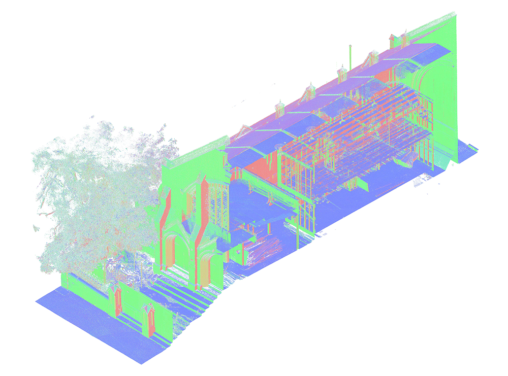
1
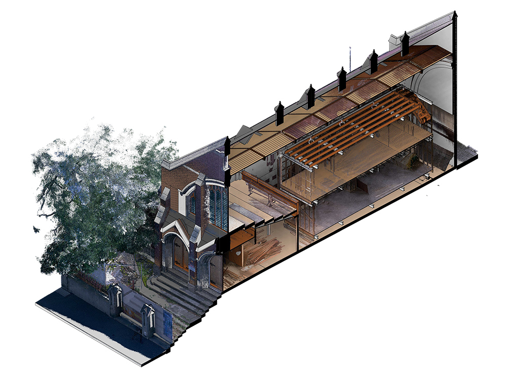
We generate the point cloud with millimeter precision using photogrammetric and lasergametric tools.
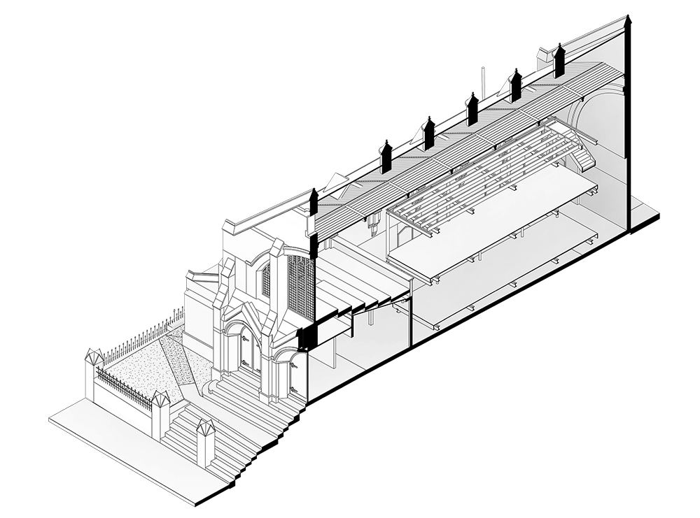
2
We model all the elements in BIM to then create detailed 2D documentation of the project.
3